 |
| Area Overview from Google Earth. Yellow line is Hwy89. Yellow pin is approx.lunch/photo spot |
 |
| Perimeter July 2, Pin 1 is approx lunch spot. Pin 3 is Matt Oss' video location |
 |
| From Inciweb - AZ State Forestry |
 |
| From AZcentral.com |
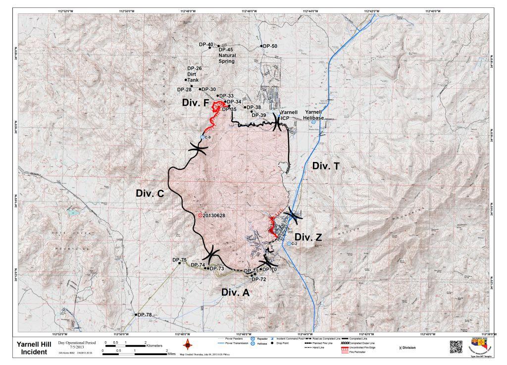 | |
| From Inciweb - AZ State Forestry |
No comments:
Post a Comment